
Geology
Please wait for the page to fully load before starting your mission!
The Importance of my Job:
Remember, a successful sample retrieval is necessary for getting the samples back to Earth where scientists can study them for signs of past water and possibly life!
continue on to next section
Background
BACKGROUND
In this mission, you will be collaborating with the Navigation (NAV) and Energy (NRG) teams to collect samples with the Sample Fetch Rover (SFR). You are responsible for analyzing the terrain to make sure it is safe for the rover to travel on. The image below shows the different parts of the rover, and describes the use of each part.

continue on to next section
Research
TERRAIN
There are four main types of terrain that the rover could encounter in Jezero crater: Smooth regolith, Sand ripples, Cratered terrain, and Rocky terrain. Continue reading to get a definition of each terrain type. Below each definition, you will see photos showing what this terrain type looks like on Mars and on Earth.
Smooth regolith is the easiest terrain for the rover to travel on. “Regolith” refers to a layer of loose sand and rocky material on top of hard, flat rock. This terrain looks like smooth, flat ground. It might have a few small rocks, or look a bit sandy, but there are no sand dunes.

Terrain with sand ripples looks similar to sand dunes on Earth. In places where the dust on the surface of Mars is very thick, it has been shaped into waves or ripples. We call this terrain type sand ripples.

Cratered terrain is smooth or slightly sandy terrain with one or more distinct craters. The craters will look like shallow circular holes in the surface, with a slightly raised rim. The terrain around the crater might look smooth, sandy, or rocky. But, if there is at least one crater in the area, then the terrain is cratered.

The final terrain type, rocky terrain, is characterized by the many rocks that are present. These rocks stick up from the surface, and are usually a slightly different color than the surrounding dusty surface. This terrain type requires the most energy for the rover to travel on.

GEO RESEARCH QUESTIONS


STOP HERE UNTIL YOU GET A MESSAGE FROM NAV WITH A PATH SELECTION.
Terrain Analysis
geo terrain data log
Notepad
continue on to next section
Elevation
ELEVATION
Because the samples that you are retrieving today are located inside Jezero crater on Mars, most of the elevations you look at today will be negative, or “below the zero elevation.”
Slope is a word that scientists use to describe how steep something is. The slope of a path tells you how quickly the elevation rises or falls as you travel along the path. Slope is determined by looking at how much the elevation changes and how long the path is.
geo elevation data log
Notepad
For example, if the path length is 4 kilometers and the elevation change is 130 meters, then the slope is “moderate.”
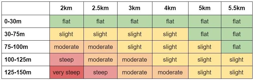
Chart of Path Length in km and the Elevation Change in meters to determine Slope. The slopes determine by Path length and elevation change can be determined as flat, slight, moderate, steep or very steep.
continue on to next section
Upon Reaching The Depot
geo wheel condition research
1. If the wear on the wheels is low, please let NRG know that no action is required:
This is GEO. I have a message for the NRG team. I have examined the condition of the wear on the wheels. Based on my evaluation, there is only low wear on the wheels. No action is required.
2. If the wear on the wheels is moderate, please let NRG know that the rover should drive backwards and at half speed for its return trip to the MAV:
This is GEO. I have a message for the NRG team. I have examined the condition of the wear on the wheels. Based on my evaluation, there is moderate wear on the wheels. My recommendation is that we drive backwards and at half speed to return to the MAV.
3. If the wear on the wheels is extreme, please let all teams know that the rover may be unable to complete the journey back:
This is GEO. I have a message for ALL teams. I have examined the condition of the wear on the wheels. Based on my evaluation, there is extreme wear on the wheels. The rover may not be able to complete the journey back to the MAV. We should consult the FLIGHT DIRECTOR for guidance on how to proceed with the mission.
Watch this video of Perseverance exploring the Jezero Crater Delta.
continue on to next section
Make a Final Decision

Sample Image of where to find the pen tool, text tool, and more on the Mission Decision Board. The pen tool, post-it note and text box buttons are all to the left of the Mission Decision Board. The pen tool is first, the post-it note is fourth and the text box is seventh.
While you wait, did you know:
And, click here to explore the rock samples collected by the actual Perseverance Rover!
And, click here to explore the rock samples collected by the actual Perseverance Rover!
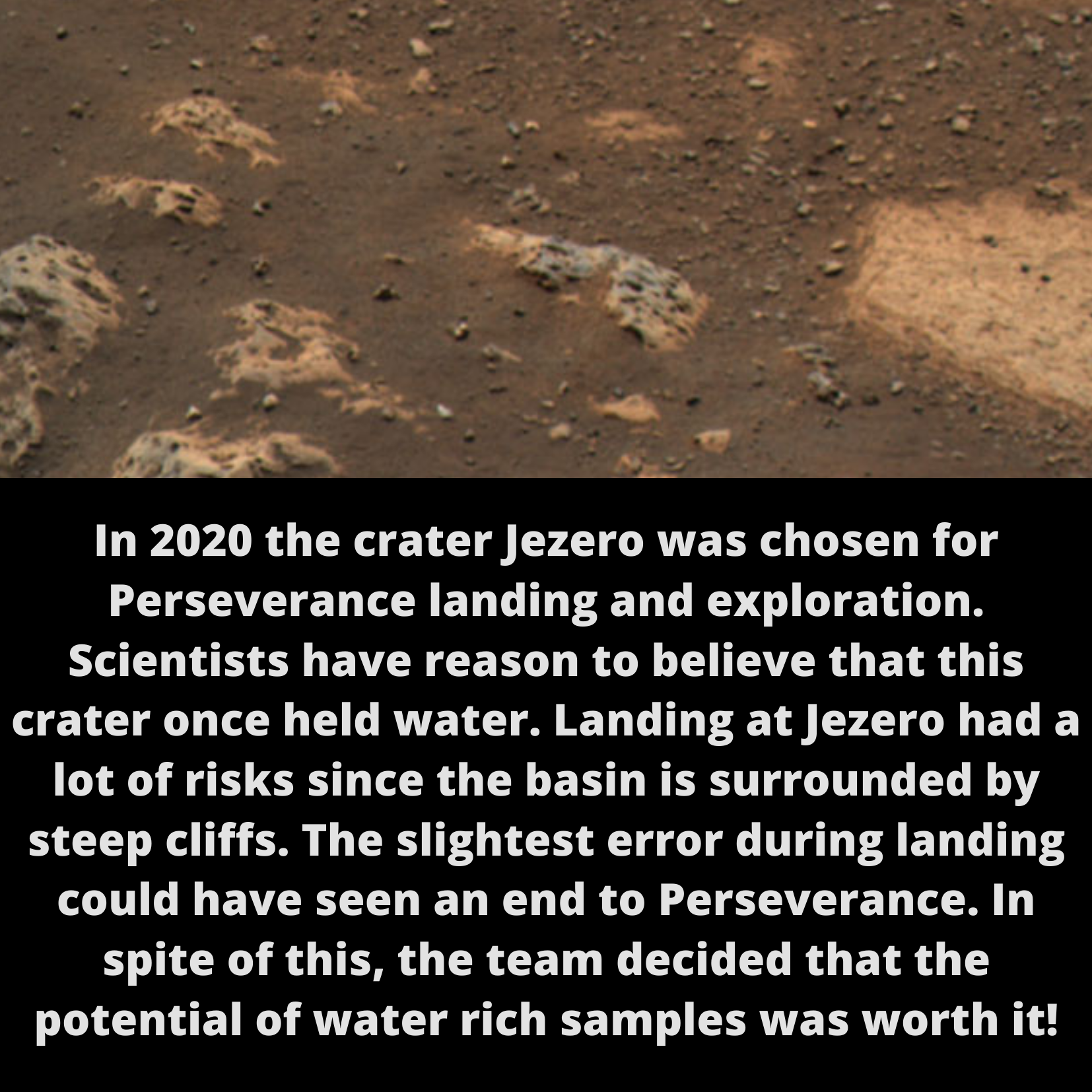
In 2020 the crater Jezero was chosen for Perseverance landing and exploration. Scientists have reason to believe that this crater once held water. Landing at Jezero had a lot of risks since the basin is surrounded by steep cliffs. The slightest error during landing could have seen an end to Perseverance. In spite of this, the team decided that the potential of water rich samples was worth it!
Congratulations, GEO, and here’s hoping for a successful mission ahead!
Select Next Path
Once the rover successfully returns the samples collected on the path chosen by NAV, it is time to plan for a second Sample Fetch Rover mission. If you were to send the rover to a second depot, which path would you select? Follow the directions below to select which path the rover should visit next.

Diversity of samples that may be discovered within the mission. 20 samples inside the Jezero system and 17 outside the Jezero system.

Diversity of samples broken down into four groups. Path A, 7 samples. Path B, 6 samples. Path C, 7 samples. Path D, 17 samples.